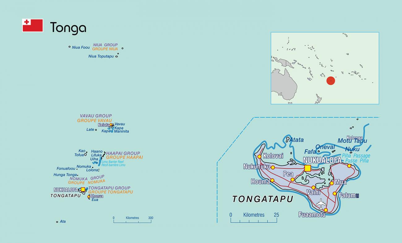
Tonga
Capital: Nuku’alofa Land area: 749 km² Region: Polynesia
Tonga comprises of 169 islands spread out across approximately 800 kilometres from north to south. It is surrounded by Fiji and Wallis and Futuna to the northwest, Samoa to the northeast, Niue to the east and New Caledonia and Vanuatu farther to the west.
Key Statistics
Census & Surveys
2024Multiple indicator cluster survey
2024Household Income and Expenditure Survey
2026Population and Housing Census
News & Publications
Population Pyramid
PDH.stat datasets
- .statAbout PICTsThis table provides a series of non-statistical information about Pacific Islands Countries and Territories (PICTs).
- .statOverseas visitor arrivalsOverseas visitors include sea and air arrivals. It includes excursionists/same-day-visitors i.e. visitors from the cruise ship as well. [...]
- .statBalance of paymentsBalance of payments data from IMF’s Balance of Payment analytical presentation per country for Pacific Island Countries and Territories.
- .statCOVID-19 cases in Pacific Island Countries and TerritoriesStatistics from SPC's Public Health Division (PHD) on the number of cases of COVID-19 and the number of deaths attributed to COVID-19 in Pacific Island [...]
- .statCivil Registration Completeness within 12 months of Birth or DeathEstimations of civil registration completeness within 12 months of birth or 12 months of death. [...]
Country Key Reports
Census
pdfSampling guidelines for the Pacific
PDF | 3.51 MB
pdfDisability in Tonga: analysis of the situation of people with disability based on the 2016 population and housing census
PDF | 769.48 KB
pdfTonga 2011 census of population and housing
PDF | 9.59 MB | Tonga.
Household Income and Expenditure Surveys
pdfSampling guidelines for the Pacific
PDF | 3.51 MB
pdfGuidelines for the harmonisation of census and survey microdata
PDF | 6.43 MB
pdfTonga 2021 household income and expenditure survey report
PDF | 6.02 MB
Demographic and Health Surveys
pdfTonga 2019 MICS Survey Findings Report
PDF | 34.2 MB
pdfTonga Demographic and Health Survey 2012
PDF | 4.52 MB
Civil Registration and Vital Statistics
pdfInteroperability and data sharing between civil registration, health information, statistics and associated systems
PDF | 6.58 MB
pdfBrief: interoperability and data sharing between civil registration, health information, statistics and associated systems
PDF | 732.97 KB
pdfCRVS Roadmap checklist
PDF | 581.81 KB
Other
xlsTonga IMTS Tables
Excel
Other Resources
General listing of Tonga, datasets and publications.
Latest statistics and releases from the Statistics Department, including CPI releases, downloads Yearbooks, and more.
The Pacific Environment Portal provides an easy way to find, access and reuse regional and national data.
Documented Censuses and Surveys related to Tonga.
Requests for download of microdata for selected datasets is possible.
Find information about Tonga including National Strategy for Development of Statistics (NSDS).
The Social Protection Indicator for the Pacific: Assessing Progress.
Statistics Act available via Pacific Islands Legal Information Institute.